Saltar al contenido
BajaStorms

Tormenta tropical Elida

Sin vigilancia/aviso oficial para Baja

Se monitorea la tormenta tropical Elida en el Pacífico oriental.

Aviso de Elida actualizado:

Fuente: NOAA / National Hurricane Center (NHC)

Datos clave

Tipo
Tormenta tropical
Viento máximo sostenido
104 km/h
Presión mínima
994 mb
Movimiento
WNW 17 km/h
Distancia a Baja
1266 km

Trayectoria pronosticada

Elida | Tormenta tropical | Viento máx. 104 km/h
DepresiónTormenta tropicalHuracánHuracán mayor

Seguimiento construido por BajaStorms con datos de NOAA / National Hurricane Center (NHC).

Gráficos oficiales

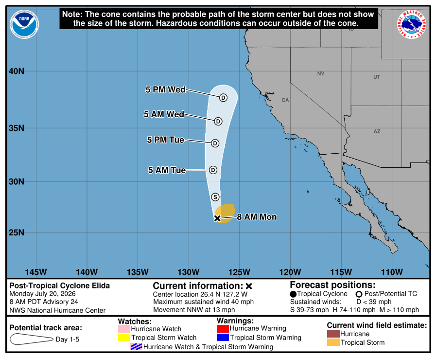
Cono de pronóstico oficial del NHC17 jul, 7:37 a.m. GMT-7
Cono y trayectoria oficial actual del NHC para Elida
Cono y trayectoria oficial actual del NHC.NHC ↗
Trayectorias de modelos17 jul, 5:00 a.m. GMT-7
10°N20°N30°N40°N50°N150°W140°W130°W120°W110°W100°W
GFSGFS ensemble meanHAFS-AHAFS-BHMONHCCA consensus
Gráfico de BajaStormsFuente: NOAA/NHC ATCF A-deck

Guía construida: No es el pronóstico oficial del NHC

Cronología de avisos

  1. Cronología de avisos #12

    Elida still has not shown much change in intensity.

    Texto oficial del aviso del NHC
    ZCZC MIATCPEP5 ALL
    TTAA00 KNHC DDHHMM
     
    BULLETIN
    Tropical Storm Elida Advisory Number  12
    NWS National Hurricane Center Miami FL       EP052026
    800 AM PDT Fri Jul 17 2026
     
    ...ELIDA STILL HAS NOT SHOWN MUCH CHANGE IN INTENSITY...
     
     
    SUMMARY OF 800 AM PDT...1500 UTC...INFORMATION
    ----------------------------------------------
    LOCATION...16.8N 120.8W
    ABOUT 825 MI...1325 KM WSW OF THE SOUTHERN TIP OF BAJA CALIFORNIA
    MAXIMUM SUSTAINED WINDS...65 MPH...100 KM/H
    PRESENT MOVEMENT...WNW OR 300 DEGREES AT 10 MPH...17 KM/H
    MINIMUM CENTRAL PRESSURE...994 MB...29.36 INCHES
     
     
    WATCHES AND WARNINGS
    --------------------
    There are no coastal watches or warnings in effect.
     
     
    DISCUSSION AND OUTLOOK
    ----------------------
    At 800 AM PDT (1500 UTC), the center of Tropical Storm Elida was 
    located near latitude 16.8 North, longitude 120.8 West. Elida is 
    moving toward the west-northwest near 10 mph (17 km/h). A turn 
    toward the northwest is expected later today, followed by a 
    north-northwestward motion at a slightly faster forward speed by 
    Sunday.
     
    Maximum sustained winds are near 65 mph (100 km/h) with higher
    gusts.  Some strengthening is possible, and Elida could still 
    become a hurricane within the next day. Weakening is expected 
    to start over the weekend and continue into early next week. 
     
    Tropical-storm-force winds extend outward up to 160 miles (260 km)
    from the center.
     
    The estimated minimum central pressure is 994 mb (29.36 inches).
     
     
    HAZARDS AFFECTING LAND
    ----------------------
    SURF:  Swells generated by Elida will affect portions of the west
    coast of the Baja California peninsula through this weekend. These
    swells are likely to cause life-threatening surf and rip current
    conditions. Please consult products from your local weather office.
     
     
    NEXT ADVISORY
    -------------
    Next complete advisory at 200 PM PDT.
     
    $$
    Forecaster Katz/Cangialosi
     
    NNNN

    Fuente: NOAA / NHC

  2. Cronología de avisos #11

    Boletín número 11 de la Tormenta Tropical Elida

    Traducción automática no oficial
    ZCZC MIATCPEP5 ALL
    TTAA00 KNHC DDHHMM
     
    BOLETÍN
    Boletín número 11 de la Tormenta Tropical Elida
    NWS National Hurricane Center Miami FL       EP052026
    200 AM PDT vie 17 jul 2026
     
    ...ELIDA CAMBIA POCO EN INTENSIDAD PERO AÚN SE PRONOSTICA QUE SE
    CONVIERTA EN HURACÁN MÁS TARDE HOY...
     
     
    RESUMEN DE INFORMACIÓN DE LAS 200 AM PDT...0900 UTC
    ----------------------------------------------
    UBICACIÓN...16.1N 120.2W
    A UNAS 820 MI...1315 KM OSO DEL EXTREMO SUR DE BAJA CALIFORNIA
    VIENTOS MÁXIMOS SOSTENIDOS...65 MPH...100 KM/H
    MOVIMIENTO ACTUAL...O O 280 GRADOS A 10 MPH...17 KM/H
    PRESIÓN CENTRAL MÍNIMA...994 MB...29.36 PULGADAS
     
     
    VIGILANCIAS Y AVISOS
    --------------------
    No hay vigilancias ni avisos costeros en efecto.
     
     
    DISCUSIÓN Y PRONÓSTICO
    ----------------------
    A las 200 AM PDT (0900 UTC), el centro de la Tormenta Tropical Elida
    se ubicaba cerca de la latitud 16.1 Norte, longitud 120.2 Oeste. Elida
    se está moviendo hacia el oeste cerca de 10 mph (17 km/h). Se espera un
    giro hacia el oeste-noroeste y noroeste más tarde hoy, seguido por un
    movimiento hacia el norte-noroeste a una velocidad de avance ligeramente
    más rápida para el domingo.
     
    Los vientos máximos sostenidos están cerca de 65 mph (100 km/h), con
    rachas más fuertes. Se pronostica fortalecimiento durante el próximo día
    o así, y Elida podría convertirse en huracán más tarde hoy. Se espera
    que el debilitamiento comience durante el fin de semana y continúe hasta
    inicios de la próxima semana.
     
    Los vientos de fuerza de tormenta tropical se extienden hacia afuera hasta
    160 millas (260 km) desde el centro.
     
    La presión central mínima estimada es de 994 mb (29.36 pulgadas).
     
     
    PELIGROS QUE AFECTAN TIERRA
    ----------------------
    OLEAJE:  Los marejadas generadas por Elida afectarán porciones de la costa
    occidental de la península de Baja California durante este fin de semana.
    Estas marejadas probablemente causarán condiciones de oleaje y corrientes de
    resaca que ponen en peligro la vida. Consulte los productos de su oficina
    meteorológica local.
     
     
    PRÓXIMO AVISO
    -------------
    Próximo aviso completo a las 800 AM PDT.
     
    $$
    Pronosticador Berg
     
    NNNN
    Texto oficial del aviso del NHC
    ZCZC MIATCPEP5 ALL
    TTAA00 KNHC DDHHMM
     
    BULLETIN
    Tropical Storm Elida Advisory Number  11
    NWS National Hurricane Center Miami FL       EP052026
    200 AM PDT Fri Jul 17 2026
     
    ...ELIDA CHANGES LITTLE IN INTENSITY BUT STILL FORECAST TO BECOME A
    HURRICANE LATER TODAY...
     
     
    SUMMARY OF 200 AM PDT...0900 UTC...INFORMATION
    ----------------------------------------------
    LOCATION...16.1N 120.2W
    ABOUT 820 MI...1315 KM WSW OF THE SOUTHERN TIP OF BAJA CALIFORNIA
    MAXIMUM SUSTAINED WINDS...65 MPH...100 KM/H
    PRESENT MOVEMENT...W OR 280 DEGREES AT 10 MPH...17 KM/H
    MINIMUM CENTRAL PRESSURE...994 MB...29.36 INCHES
     
     
    WATCHES AND WARNINGS
    --------------------
    There are no coastal watches or warnings in effect.
     
     
    DISCUSSION AND OUTLOOK
    ----------------------
    At 200 AM PDT (0900 UTC), the center of Tropical Storm Elida was
    located near latitude 16.1 North, longitude 120.2 West. Elida is
    moving toward the west near 10 mph (17 km/h). A turn toward the 
    west-northwest and northwest is expected later today, followed by a 
    north-northwestward motion at a slightly faster forward speed by 
    Sunday.
     
    Maximum sustained winds are near 65 mph (100 km/h) with higher
    gusts. Strengthening is forecast during the next day or so, and 
    Elida could become a hurricane later today. Weakening is expected 
    to begin over the weekend and continue into early next week.
     
    Tropical-storm-force winds extend outward up to 160 miles (260 km)
    from the center.
     
    The estimated minimum central pressure is 994 mb (29.36 inches).
     
     
    HAZARDS AFFECTING LAND
    ----------------------
    SURF:  Swells generated by Elida will affect portions of the west
    coast of the Baja California peninsula through this weekend. These
    swells are likely to cause life-threatening surf and rip current
    conditions. Please consult products from your local weather office.
     
     
    NEXT ADVISORY
    -------------
    Next complete advisory at 800 AM PDT.
     
    $$
    Forecaster Berg
     
    NNNN

    Fuente: NOAA / NHC

  3. Cronología de avisos #10

    Elida pronosticada para convertirse en huracán el viernes.

    Traducción automática no oficial
    ZCZC MIATCPEP5 ALL
    TTAA00 KNHC DDHHMM
     
    BOLETÍN
    Aviso Número 10 de la Tormenta Tropical Elida
    NWS National Hurricane Center Miami FL       EP052026
    800 PM PDT Thu Jul 16 2026
     
    ...ELIDA PRONOSTICADA PARA CONVERTIRSE EN HURACÁN EL VIERNES...
     
     
    RESUMEN DE LA INFORMACIÓN DE LAS 800 PM PDT...0300 UTC
    ----------------------------------------------
    UBICACIÓN...15.9N 119.1W
    A UNAS 770 MI...1240 KM AL SW DEL EXTREMO SUR DE BAJA CALIFORNIA
    VIENTOS MÁXIMOS SOSTENIDOS...65 MPH...100 KM/H
    MOVIMIENTO ACTUAL...O O 280 GRADOS A 10 MPH...17 KM/H
    PRESIÓN CENTRAL MÍNIMA...994 MB...29.36 PULGADAS
     
     
    VIGILANCIAS Y AVISOS
    --------------------
    No hay vigilancias o avisos costeros en efecto.
     
     
    DISCUSIÓN Y PERSPECTIVAS
    ----------------------
    A las 800 PM PDT (0300 UTC), el centro de la Tormenta Tropical Elida 
    estaba localizado cerca de la latitud 15.9 Norte, longitud 119.1 Oeste. Elida se 
    está moviendo hacia el oeste cerca de 10 mph (17 km/h). Se espera un giro hacia el 
    oeste-noroeste esta noche y el viernes, seguido por un movimiento hacia el noroeste durante el fin de semana.
     
    Los vientos máximos sostenidos están cerca de 65 mph (100 km/h), con ráfagas más fuertes. Se pronostica fortalecimiento durante el próximo día aproximadamente, y 
    se espera que Elida se convierta en un huracán el viernes. Se pronostica que el debilitamiento comience más tarde este fin de semana y continúe hasta inicios de la próxima semana.
     
    Los vientos de fuerza de tormenta tropical se extienden hacia afuera hasta 140 millas (220 km)
    desde el centro.
     
    La presión central mínima estimada es de 994 mb (29.36 pulgadas).
     
     
    PELIGROS QUE AFECTAN TIERRA
    ----------------------
    MAREJADA:  Los oleajes generados por Elida afectarán porciones de la costa occidental de Baja California durante este fin de semana. Es probable que estos oleajes causen condiciones de resaca y corrientes de resaca que amenazan la vida.
    Consulte los productos de su oficina meteorológica local.
     
     
    PRÓXIMO AVISO
    -------------
    Próximo aviso completo a las 200 AM PDT.
     
    $$
    Pronosticador Reinhart
     
    NNNN
    Texto oficial del aviso del NHC
    ZCZC MIATCPEP5 ALL
    TTAA00 KNHC DDHHMM
     
    BULLETIN
    Tropical Storm Elida Advisory Number  10
    NWS National Hurricane Center Miami FL       EP052026
    800 PM PDT Thu Jul 16 2026
     
    ...ELIDA FORECAST TO BECOME A HURRICANE ON FRIDAY...
     
     
    SUMMARY OF 800 PM PDT...0300 UTC...INFORMATION
    ----------------------------------------------
    LOCATION...15.9N 119.1W
    ABOUT 770 MI...1240 KM SW OF THE SOUTHERN TIP OF BAJA CALIFORNIA
    MAXIMUM SUSTAINED WINDS...65 MPH...100 KM/H
    PRESENT MOVEMENT...W OR 280 DEGREES AT 10 MPH...17 KM/H
    MINIMUM CENTRAL PRESSURE...994 MB...29.36 INCHES
     
     
    WATCHES AND WARNINGS
    --------------------
    There are no coastal watches or warnings in effect.
     
     
    DISCUSSION AND OUTLOOK
    ----------------------
    At 800 PM PDT (0300 UTC), the center of Tropical Storm Elida was 
    located near latitude 15.9 North, longitude 119.1 West. Elida is 
    moving toward the west near 10 mph (17 km/h). A turn toward the 
    west-northwest is expected tonight and Friday, followed by a 
    northwestward motion through the weekend.
     
    Maximum sustained winds are near 65 mph (100 km/h) with higher 
    gusts. Strengthening is forecast during the next day or so, and 
    Elida is expected to become a hurricane on Friday. Weakening is 
    forecast to begin later this weekend and continue through early 
    next week.
     
    Tropical-storm-force winds extend outward up to 140 miles (220 km)
    from the center.
     
    The estimated minimum central pressure is 994 mb (29.36 inches).
     
     
    HAZARDS AFFECTING LAND
    ----------------------
    SURF:  Swells generated by Elida will affect portions of the west
    coast of Baja California through this weekend. These swells are
    likely to cause life-threatening surf and rip current conditions.
    Please consult products from your local weather office.
     
     
    NEXT ADVISORY
    -------------
    Next complete advisory at 200 AM PDT.
     
    $$
    Forecaster Reinhart
     
    NNNN

    Fuente: NOAA / NHC

  4. Cronología de avisos #9

    Elida se fortalece un poco. Se espera que gire hacia el noroeste esta noche y el viernes.

    Traducción automática no oficial
    ZCZC MIATCPEP5 ALL
    TTAA00 KNHC DDHHMM
     
    BOLETÍN
    Aviso del Tormenta Tropical Elida Número   9
    NWS National Hurricane Center Miami FL       EP052026
    200 PM PDT Thu Jul 16 2026
     
    ...ELIDA SE FORTALECE UN POCO...
    ...SE ESPERA QUE GIRE HACIA EL NOROESTE ESTA NOCHE Y EL VIERNES...
     
     
    RESUMEN DE 200 PM PDT...2100 UTC...INFORMACIÓN
    ----------------------------------------------
    UBICACIÓN...15.8N 118.3W
    A UNAS 735 MI...1180 KM AL SO DEL EXTREMO SUR DE BAJA CALIFORNIA
    VIENTOS MÁXIMOS SOSTENIDOS...65 MPH...100 KM/H
    MOVIMIENTO ACTUAL...O O 280 GRADOS A 10 MPH...17 KM/H
    PRESIÓN CENTRAL MÍNIMA...995 MB...29.39 PULGADAS
     
     
    VIGILANCIAS Y AVISOS
    --------------------
    No hay vigilancias o avisos costeros en efecto.
     
     
    DISCUSIÓN Y PERSPECTIVA
    ----------------------
    A las 200 PM PDT (2100 UTC), el centro de la Tormenta Tropical Elida se
    ubicaba cerca de la latitud 15.8 Norte, longitud 118.3 Oeste. Elida se
    está moviendo hacia el oeste cerca de 10 mph (17 km/h). Se espera un
    giro hacia el oeste-noroeste esta noche, seguido por un movimiento
    hacia el noroeste a partir del viernes y continuando durante el fin de semana.
     
    Los vientos máximos sostenidos están ahora cerca de 65 mph (100 km/h) con
    rachas más fuertes. Se pronostica fortalecimiento durante los próximos un
    par de días, y se espera que Elida se convierta en huracán el viernes antes
    de alcanzar su intensidad máxima la noche del viernes o el sábado.
     
    Los vientos de fuerza de tormenta tropical se extienden hacia afuera hasta
    a 125 millas (205 km) del centro.
     
    La presión central mínima estimada es de 995 mb (29.39 pulgadas).
     
     
    PELIGROS QUE AFECTAN TIERRA
    ----------------------
    Ninguno.
     
     
    PRÓXIMO AVISO
    -------------
    Próximo aviso completo a las 800 PM PDT.
     
    $$
    Pronosticador Beven
     
    NNNN
    Texto oficial del aviso del NHC
    ZCZC MIATCPEP5 ALL
    TTAA00 KNHC DDHHMM
     
    BULLETIN
    Tropical Storm Elida Advisory Number   9
    NWS National Hurricane Center Miami FL       EP052026
    200 PM PDT Thu Jul 16 2026
     
    ...ELIDA STRENGTHENS A LITTLE...
    ...EXPECTED TO TURN NORTHWESTWARD TONIGHT AND FRIDAY...
     
     
    SUMMARY OF 200 PM PDT...2100 UTC...INFORMATION
    ----------------------------------------------
    LOCATION...15.8N 118.3W
    ABOUT 735 MI...1180 KM SW OF THE SOUTHERN TIP OF BAJA CALIFORNIA
    MAXIMUM SUSTAINED WINDS...65 MPH...100 KM/H
    PRESENT MOVEMENT...W OR 280 DEGREES AT 10 MPH...17 KM/H
    MINIMUM CENTRAL PRESSURE...995 MB...29.39 INCHES
     
     
    WATCHES AND WARNINGS
    --------------------
    There are no coastal watches or warnings in effect.
     
     
    DISCUSSION AND OUTLOOK
    ----------------------
    At 200 PM PDT (2100 UTC), the center of Tropical Storm Elida was
    located near latitude 15.8 North, longitude 118.3 West. Elida is
    moving toward the west near 10 mph (17 km/h). A turn toward the
    west-northwest is expected tonight, followed by a northwestward
    motion beginning Friday and continuing through the weekend.
     
    Maximum sustained winds are now near 65 mph (100 km/h) with higher
    gusts.  Strengthening is forecast during the next couple of days, 
    and Elida is expected to become a hurricane on Friday before 
    reaching its peak intensity Friday night or Saturday.
     
    Tropical-storm-force winds extend outward up to 125 miles (205 km)
    from the center.
     
    The estimated minimum central pressure is 995 mb (29.39 inches).
     
     
    HAZARDS AFFECTING LAND
    ----------------------
    None.
     
     
    NEXT ADVISORY
    -------------
    Next complete advisory at 800 PM PDT.
     
    $$
    Forecaster Beven
     
    NNNN

    Fuente: NOAA / NHC

  5. Cronología de avisos #8

    Elida sigue moviéndose hacia el oeste con poco cambio en su intensidad.

    Traducción automática no oficial
    ZCZC MIATCPEP5 ALL
    TTAA00 KNHC DDHHMM
     
    BOLETÍN
    Aviso del Ciclón Tropical Elida Número   8
    NWS National Hurricane Center Miami FL       EP052026
    800 AM PDT Thu Jul 16 2026
     
    ...ELIDA SIGUE MOVIÉNDOSE HACIA EL OESTE CON POCO CAMBIO EN SU INTENSIDAD...
     
     
    RESUMEN DE LA INFORMACIÓN DE LAS 800 AM PDT...1500 UTC
    ------------------------------------------------------
    UBICACIÓN...15.7N 117.4W
    A UNAS 695 MI...1120 KM AL SO DE LA PUNTA SUR DE BAJA CALIFORNIA
    VIENTOS MÁXIMOS SOSTENIDOS...60 MPH...95 KM/H
    MOVIMIENTO ACTUAL...O O 280 GRADOS A 13 MPH...20 KM/H
    PRESIÓN CENTRAL MÍNIMA...997 MB...29.44 PULGADAS
     
     
    VIGILANCIAS Y AVISOS
    --------------------
    No hay vigilancias ni avisos costeros en efecto.
     
     
    DISCUSIÓN Y PERSPECTIVAS
    ------------------------
    A las 800 AM PDT (1500 UTC), el centro de la Tormenta Tropical Elida
    se localizaba cerca de la latitud 15.7 Norte, longitud 117.4 Oeste.
    Elida se está moviendo hacia el oeste cerca de 13 mph (20 km/h). Se
    a espera un giro hacia el oeste-noroeste esta noche, seguido por un
    movimiento hacia el noroeste comenzando el viernes y continuando
    hasta el fin de semana.
     
    Los vientos máximos sostenidos están cerca de 60 mph (95 km/h), con
    rachas más fuertes. Se pronostica fortalecimiento durante los próximos
    par de días, y se espera que Elida se convierta en huracán tarde esta
    noche o el viernes antes de alcanzar su intensidad máxima la noche
    del viernes o el sábado.
     
    Los vientos con fuerza de tormenta tropical se extienden hacia afuera
    hasta 125 millas (205 km) del centro.
     
    La presión central mínima estimada es de 997 mb (29.44 pulgadas).
     
     
    PELIGROS QUE AFECTAN TIERRAS
    ----------------------------
    Ninguno.
     
     
    PRÓXIMO AVISO
    -------------
    Próximo aviso completo a las 200 PM PDT.
     
    $$
    Pronosticador Beven
     
    NNNN
    Texto oficial del aviso del NHC
    ZCZC MIATCPEP5 ALL
    TTAA00 KNHC DDHHMM
     
    BULLETIN
    Tropical Storm Elida Advisory Number   8
    NWS National Hurricane Center Miami FL       EP052026
    800 AM PDT Thu Jul 16 2026
     
    ...ELIDA STILL MOVING WESTWARD WITH LITTLE CHANGE IN STRENGTH...
     
     
    SUMMARY OF 800 AM PDT...1500 UTC...INFORMATION
    ----------------------------------------------
    LOCATION...15.7N 117.4W
    ABOUT 695 MI...1120 KM SW OF THE SOUTHERN TIP OF BAJA CALIFORNIA
    MAXIMUM SUSTAINED WINDS...60 MPH...95 KM/H
    PRESENT MOVEMENT...W OR 280 DEGREES AT 13 MPH...20 KM/H
    MINIMUM CENTRAL PRESSURE...997 MB...29.44 INCHES
     
     
    WATCHES AND WARNINGS
    --------------------
    There are no coastal watches or warnings in effect.
     
     
    DISCUSSION AND OUTLOOK
    ----------------------
    At 800 AM PDT (1500 UTC), the center of Tropical Storm Elida was
    located near latitude 15.7 North, longitude 117.4 West. Elida is
    moving toward the west near 13 mph (20 km/h). A turn toward the
    west-northwest is expected tonight, followed by a northwestward 
    motion beginning Friday and continuing through the weekend.
     
    Maximum sustained winds are near 60 mph (95 km/h) with higher gusts.
    Strengthening is forecast during the next couple of days, and Elida 
    is expected to become a hurricane late tonight or on Friday before 
    reaching its peak intensity Friday night or Saturday.
     
    Tropical-storm-force winds extend outward up to 125 miles (205 km)
    from the center.
     
    The estimated minimum central pressure is 997 mb (29.44 inches).
     
     
    HAZARDS AFFECTING LAND
    ----------------------
    None.
     
     
    NEXT ADVISORY
    -------------
    Next complete advisory at 200 PM PDT.
     
    $$
    Forecaster Beven
     
    NNNN

    Fuente: NOAA / NHC

  6. Cronología de avisos #7

    Elida se mantiene estable mientras continúa hacia el oeste.

    Traducción automática no oficial
    ZCZC MIATCPEP5 ALL
    TTAA00 KNHC DDHHMM
     
    BOLETÍN
    Aviso del Ciclón Tropical Elida Número   7
    NWS National Hurricane Center Miami FL       EP052026
    200 AM PDT Thu Jul 16 2026
     
    ...ELIDA SE MANTIENE ESTABLE MIENTRAS CONTINÚA HACIA EL OESTE...
     
     
    RESUMEN DE LA INFORMACIÓN DE LAS 200 AM PDT...0900 UTC
    ----------------------------------------------
    UBICACIÓN...15.6N 116.5W
    A UNAS 660 MI...1065 KM AL SO DEL EXTREMO SUR DE BAJA CALIFORNIA
    VIENTOS MÁXIMOS SOSTENIDOS...60 MPH...95 KM/H
    MOVIMIENTO ACTUAL...O O 275 GRADOS A 12 MPH...19 KM/H
    PRESIÓN CENTRAL MÍNIMA...997 MB...29.44 PULGADAS
     
     
    VIGILANCIAS Y AVISOS
    --------------------
    No hay vigilancias ni avisos costeros en efecto.
     
     
    DISCUSIÓN Y PERSPECTIVA
    ----------------------
    A las 200 AM PDT (0900 UTC), el centro de la Tormenta Tropical Elida se encontraba
    cerca de la latitud 15.6 Norte, longitud 116.5 Oeste. Elida se está
    moviendo hacia el oeste cerca de 12 mph (19 km/h). Se espera un giro hacia el
    oeste-noroeste para la noche del jueves, seguido por un
    movimiento hacia el noroeste comenzando el viernes y continuando durante el
    fin de semana.
     
    Los vientos máximos sostenidos son de cerca de 60 mph (95 km/h), con rachas más fuertes.
    Se pronostica fortalecimiento adicional durante los próximos un par de días,
    y se espera que Elida se convierta en huracán la noche del jueves o temprano el
    viernes antes de alcanzar su intensidad máxima el viernes.
     
    Los vientos con fuerza de tormenta tropical se extienden hacia afuera hasta 125 millas (205 km)
    desde el centro.
     
    La presión central mínima estimada es de 997 mb (29.44 pulgadas).
     
     
    PELIGROS QUE AFECTAN TIERRA
    ----------------------
    Ninguno.
     
     
    PRÓXIMO AVISO
    -------------
    Próximo aviso completo a las 800 AM PDT.
     
    $$
    Pronosticador Gibbs (CPHC)
     
    NNNN
    Texto oficial del aviso del NHC
    ZCZC MIATCPEP5 ALL
    TTAA00 KNHC DDHHMM
     
    BULLETIN
    Tropical Storm Elida Advisory Number   7
    NWS National Hurricane Center Miami FL       EP052026
    200 AM PDT Thu Jul 16 2026
     
    ...ELIDA HOLDING STEADY AS IT CONTINUES WESTWARD...
     
     
    SUMMARY OF 200 AM PDT...0900 UTC...INFORMATION
    ----------------------------------------------
    LOCATION...15.6N 116.5W
    ABOUT 660 MI...1065 KM SW OF THE SOUTHERN TIP OF BAJA CALIFORNIA
    MAXIMUM SUSTAINED WINDS...60 MPH...95 KM/H
    PRESENT MOVEMENT...W OR 275 DEGREES AT 12 MPH...19 KM/H
    MINIMUM CENTRAL PRESSURE...997 MB...29.44 INCHES
     
     
    WATCHES AND WARNINGS
    --------------------
    There are no coastal watches or warnings in effect.
     
     
    DISCUSSION AND OUTLOOK
    ----------------------
    At 200 AM PDT (0900 UTC), the center of Tropical Storm Elida was 
    located near latitude 15.6 North, longitude 116.5 West. Elida is 
    moving toward the west near 12 mph (19 km/h). A turn toward the 
    west-northwest is expected Thursday night, followed by a 
    northwestward motion beginning Friday and continuing through the 
    weekend.
     
    Maximum sustained winds are near 60 mph (95 km/h) with higher gusts. 
    Additional strengthening is forecast during the next couple of days, 
    and Elida is expected to become a hurricane Thursday night or early 
    Friday before reaching its peak intensity on Friday.
     
    Tropical-storm-force winds extend outward up to 125 miles (205 km)
    from the center.
     
    The estimated minimum central pressure is 997 mb (29.44 inches).
     
     
    HAZARDS AFFECTING LAND
    ----------------------
    None.
     
     
    NEXT ADVISORY
    -------------
    Next complete advisory at 800 AM PDT.
     
    $$
    Forecaster Gibbs (CPHC)
     
    NNNN

    Fuente: NOAA / NHC

  7. Cronología de avisos #6

    Elida continúa fortaleciéndose.

    Traducción automática no oficial
    ZCZC MIATCPEP5 ALL
    TTAA00 KNHC DDHHMM
     
    BULLETIN
    Aviso de la Tormenta Tropical Elida Número   6
    NWS National Hurricane Center Miami FL       EP052026
    800 PM PDT Wed Jul 15 2026
     
    ...ELIDA CONTINÚA FORTALECIÉNDOSE...
     
     
    RESUMEN DE LAS 800 PM PDT...0300 UTC...INFORMACIÓN
    ----------------------------------------------
    UBICACIÓN...15.4N 115.2W
    APROXIMADAMENTE 620 MI...1000 KM AL SW DEL EXTREMO SUR DE BAJA CALIFORNIA
    VIENTOS MÁXIMOS SOSTENIDOS...60 MPH...95 KM/H
    MOVIMIENTO ACTUAL...O O 275 GRADOS A 13 MPH...20 KM/H
    PRESIÓN CENTRAL MÍNIMA...997 MB...29.44 PULGADAS
     
     
    VIGILANCIAS Y ADVERTENCIAS
    --------------------
    No hay vigilancias ni advertencias costeras en efecto.
     
     
    DISCUSIÓN Y PERSPECTIVA
    ----------------------
    A las 800 PM PDT (0300 UTC), el centro de la Tormenta Tropical Elida 
    estaba localizado cerca de la latitud 15.4 Norte, longitud 115.2 Oeste. Elida se 
    mueve hacia el oeste cerca de 13 mph (20 km/h). Se espera un giro hacia el 
    oeste-noroeste el jueves, seguido de un movimiento hacia el noroeste a partir 
    del viernes y continuando durante el fin de semana.
     
    Los vientos máximos sostenidos han aumentado a cerca de 60 mph (95 km/h) con 
    ráfagas más altas. Se espera un fortalecimiento adicional durante los próximos 
    dos días, y Elida podría convertirse en huracán para la noche del jueves 
    o temprano el viernes.
     
    Los vientos de fuerza de tormenta tropical se extienden hacia afuera hasta 115 millas (185 km)
    principalmente al este del centro.
     
    La presión central mínima estimada es de 997 mb (29.44 pulgadas).
     
     
    PELIGROS QUE AFECTAN TIERRA
    ----------------------
    Ninguno.
     
     
    PRÓXIMO AVISO
    -------------
    El próximo aviso completo será a las 200 AM PDT.
     
    $$
    Pronosticador Reinhart
     
    NNNN
    Texto oficial del aviso del NHC
    ZCZC MIATCPEP5 ALL
    TTAA00 KNHC DDHHMM
     
    BULLETIN
    Tropical Storm Elida Advisory Number   6
    NWS National Hurricane Center Miami FL       EP052026
    800 PM PDT Wed Jul 15 2026
     
    ...ELIDA CONTINUES TO STRENGTHEN...
     
     
    SUMMARY OF 800 PM PDT...0300 UTC...INFORMATION
    ----------------------------------------------
    LOCATION...15.4N 115.2W
    ABOUT 620 MI...1000 KM SW OF THE SOUTHERN TIP OF BAJA CALIFORNIA
    MAXIMUM SUSTAINED WINDS...60 MPH...95 KM/H
    PRESENT MOVEMENT...W OR 275 DEGREES AT 13 MPH...20 KM/H
    MINIMUM CENTRAL PRESSURE...997 MB...29.44 INCHES
     
     
    WATCHES AND WARNINGS
    --------------------
    There are no coastal watches or warnings in effect.
     
     
    DISCUSSION AND OUTLOOK
    ----------------------
    At 800 PM PDT (0300 UTC), the center of Tropical Storm Elida was 
    located near latitude 15.4 North, longitude 115.2 West. Elida is 
    moving toward the west near 13 mph (20 km/h). A turn toward the 
    west-northwest is expected on Thursday, followed by a northwestward 
    motion beginning on Friday and continuing through the weekend.
     
    Maximum sustained winds have increased to near 60 mph (95 km/h) with 
    higher gusts. Additional strengthening is expected during the next 
    couple of days, and Elida could become a hurricane by Thursday night 
    or early Friday.
     
    Tropical-storm-force winds extend outward up to 115 miles (185 km)
    mainly to the east of the center.
     
    The estimated minimum central pressure is 997 mb (29.44 inches).
     
     
    HAZARDS AFFECTING LAND
    ----------------------
    None.
     
     
    NEXT ADVISORY
    -------------
    Next complete advisory at 200 AM PDT.
     
    $$
    Forecaster Reinhart
     
    NNNN

    Fuente: NOAA / NHC

  8. Cronología de avisos #5

    Elida se fortalece un poco más.

    Traducción automática no oficial
    ZCZC MIATCPEP5 ALL
    TTAA00 KNHC DDHHMM
     
    BOLETÍN
    Aviso del Ciclón Tropical Elida Número 5
    NWS National Hurricane Center Miami FL       EP052026
    200 PM MST Mié Jul 15 2026
     
    ...ELIDA SE FORTALECE UN POCO MÁS...
     
     
    RESUMEN DE LAS 200 PM MST...2100 UTC...INFORMACIÓN
    ----------------------------------------------
    UBICACIÓN...15.7N 114.6W
    A UNAS 585 MI...940 KM SSO DEL EXTREMO SUR DE BAJA CALIFORNIA
    VIENTOS MÁXIMOS SOSTENIDOS...50 MPH...85 KM/H
    MOVIMIENTO PRESENTE...O O 280 GRADOS A 14 MPH...22 KM/H
    PRESIÓN CENTRAL MÍNIMA...999 MB...29.50 PULGADAS
     
     
    VIGILANCIAS Y AVISOS
    --------------------
    No hay vigilancias ni avisos costeros en efecto.
     
     
    DISCUSIÓN Y PERSPECTIVA
    ----------------------
    A las 200 PM MST (2100 UTC), el centro de la Tormenta Tropical Elida se
    localizaba cerca de la latitud 15.7 Norte, longitud 114.6 Oeste. Elida se
    mueve hacia el oeste cerca de 14 mph (22 km/h), y se espera que este
    movimiento general continúe hoy, seguido de un giro gradual hacia el
    oeste-noroeste y noroeste durante los próximos días.
     
    Los vientos máximos sostenidos han aumentado a 50 mph (85 km/h) con
    rachas más altas. Se pronostica un fortalecimiento gradual durante el
    próximo día más o menos, seguido de una tasa de intensificación algo más
    rápida. Se pronostica que Elida se convierta en huracán el viernes.
     
    Los vientos con fuerza de tormenta tropical se extienden hacia afuera hasta
    105 millas (165 km) desde el centro.
     
    La presión central mínima estimada es de 999 mb (29.50 pulgadas).
     
     
    PELIGROS QUE AFECTAN TIERRA
    ----------------------
    Ninguno
     
     
    PRÓXIMO AVISO
    -------------
    El próximo aviso completo será a las 800 PM MST.
     
    $$
    Pronosticadores Katz/Papin
     
    NNNN
    Texto oficial del aviso del NHC
    ZCZC MIATCPEP5 ALL
    TTAA00 KNHC DDHHMM
     
    BULLETIN
    Tropical Storm Elida Advisory Number   5
    NWS National Hurricane Center Miami FL       EP052026
    200 PM MST Wed Jul 15 2026
     
    ...ELIDA STRENGTHENS A LITTLE MORE...
     
     
    SUMMARY OF 200 PM MST...2100 UTC...INFORMATION
    ----------------------------------------------
    LOCATION...15.7N 114.6W
    ABOUT 585 MI...940 KM SSW OF THE SOUTHERN TIP OF BAJA CALIFORNIA
    MAXIMUM SUSTAINED WINDS...50 MPH...85 KM/H
    PRESENT MOVEMENT...W OR 280 DEGREES AT 14 MPH...22 KM/H
    MINIMUM CENTRAL PRESSURE...999 MB...29.50 INCHES
     
     
    WATCHES AND WARNINGS
    --------------------
    There are no coastal watches or warnings in effect.
     
     
    DISCUSSION AND OUTLOOK
    ----------------------
    At 200 PM MST (2100 UTC), the center of Tropical Storm Elida was
    located near latitude 15.7 North, longitude 114.6 West. Elida is
    moving toward the west near 14 mph (22 km/h), and this general
    motion is expected to continue today followed by a gradual turn to
    the west-northwest and northwest over the next few days.
     
    Maximum sustained winds have increased to 50 mph (85 km/h) with 
    higher gusts. Gradual strengthening is forecast over the next day or 
    so followed by a somewhat faster rate of intensification. Elida is 
    forecast to become a hurricane on Friday.
     
    Tropical-storm-force winds extend outward up to 105 miles (165 km)
    from the center.
     
    The estimated minimum central pressure is 999 mb (29.50 inches).
     
     
    HAZARDS AFFECTING LAND
    ----------------------
    None
     
     
    NEXT ADVISORY
    -------------
    Next complete advisory at 800 PM MST.
     
    $$
    Forecaster Katz/Papin
     
    NNNN

    Fuente: NOAA / NHC

  9. Cronología de avisos #4

    Elida un poco más fuerte mientras se desplaza sobre el Pacífico oriental abierto.

    Traducción automática no oficial
    ZCZC MIATCPEP5 ALL
    TTAA00 KNHC DDHHMM
     
    BULLETIN
    Boletín del ciclón tropical Elida Aviso número   4
    NWS National Hurricane Center Miami FL       EP052026
    800 AM MST Wed Jul 15 2026
     
    ...ELIDA UN POCO MÁS FUERTE MIENTRAS SE DESPLAZA SOBRE EL PACÍFICO ORIENTAL ABIERTO...
     
     
    RESUMEN DE LAS 800 AM MST...1500 UTC...INFORMACIÓN
    ----------------------------------------------
    UBICACIÓN...15.4N 113.5W
    A UNAS 570 MI...915 KM SSO DEL EXTREMO SUR DE BAJA CALIFORNIA
    VIENTOS MÁXIMOS SOSTENIDOS...45 MPH...75 KM/H
    MOVIMIENTO ACTUAL...O O 280 GRADOS A 15 MPH...24 KM/H
    PRESIÓN CENTRAL MÍNIMA...1001 MB...29.56 PULGADAS
     
     
    VIGILANCIAS Y AVISOS
    --------------------
    No hay vigilancias ni avisos costeros en vigor.
     
     
    DISCUSIÓN Y PERSPECTIVA
    ----------------------
    A las 800 AM MST (1500 UTC), el centro de la Tormenta Tropical Elida se 
    ubicaba cerca de la latitud 15.4 Norte, longitud 113.5 Oeste. Elida se 
    está moviendo hacia el oeste a cerca de 15 mph (24 km/h), y se espera que 
    este movimiento general continúe hoy, seguido por un giro gradual hacia el 
    oeste-noroeste y noroeste durante los próximos días.  
     
    Los vientos máximos sostenidos han aumentado a cerca de 45 mph (75 km/h) con 
    rachas más fuertes. Se pronostica un fortalecimiento gradual durante el próximo día 
    o así, seguido por una tasa de intensificación algo más rápida. Se pronostica que 
    Elida se convierta en huracán el viernes. 
     
    Los vientos con fuerza de tormenta tropical se extienden hacia afuera hasta 90 millas (150 km)
    desde el centro.
     
    La presión central mínima estimada es de 1001 mb (29.56 pulgadas).
     
     
    PELIGROS QUE AFECTAN TIERRA
    ----------------------
    Ninguno
     
     
    PRÓXIMO AVISO
    -------------
    Próximo aviso completo a las 200 PM MST.
     
    $$
    Pronosticadores Papin/Katz
     
    NNNN
    Texto oficial del aviso del NHC
    ZCZC MIATCPEP5 ALL
    TTAA00 KNHC DDHHMM
     
    BULLETIN
    Tropical Storm Elida Advisory Number   4
    NWS National Hurricane Center Miami FL       EP052026
    800 AM MST Wed Jul 15 2026
     
    ...ELIDA A LITTLE STRONGER AS IT MOVES OVER THE OPEN EAST PACIFIC...
     
     
    SUMMARY OF 800 AM MST...1500 UTC...INFORMATION
    ----------------------------------------------
    LOCATION...15.4N 113.5W
    ABOUT 570 MI...915 KM SSW OF THE SOUTHERN TIP OF BAJA CALIFORNIA
    MAXIMUM SUSTAINED WINDS...45 MPH...75 KM/H
    PRESENT MOVEMENT...W OR 280 DEGREES AT 15 MPH...24 KM/H
    MINIMUM CENTRAL PRESSURE...1001 MB...29.56 INCHES
     
     
    WATCHES AND WARNINGS
    --------------------
    There are no coastal watches or warnings in effect.
     
     
    DISCUSSION AND OUTLOOK
    ----------------------
    At 800 AM MST (1500 UTC), the center of Tropical Storm Elida was 
    located near latitude 15.4 North, longitude 113.5 West. Elida is 
    moving toward the west near 15 mph (24 km/h), and this general 
    motion is expected to continue today followed by a gradual turn to 
    the west-northwest and northwest over the next few days.  
     
    Maximum sustained winds have increased to near 45 mph (75 km/h) with 
    higher gusts. Gradual strengthening is forecast over the next day or 
    so followed by a somewhat faster rate of intensification. Elida is 
    forecast to become a hurricane on Friday. 
     
    Tropical-storm-force winds extend outward up to 90 miles (150 km)
    from the center.
     
    The estimated minimum central pressure is 1001 mb (29.56 inches).
     
     
    HAZARDS AFFECTING LAND
    ----------------------
    None
     
     
    NEXT ADVISORY
    -------------
    Next complete advisory at 200 PM MST.
     
    $$
    Forecaster Papin/Katz
     
    NNNN

    Fuente: NOAA / NHC

  10. Cronología de avisos #3

    La depresión se intensifica y pasa a tormenta tropical Elida.

    Traducción automática no oficial
    ZCZC MIATCPEP5 ALL
    TTAA00 KNHC DDHHMM
     
    BOLETÍN
    Aviso de la Tormenta Tropical Elida Número   3
    NWS National Hurricane Center Miami FL       EP052026
    200 AM MST Mié Jul 15 2026
     
    ...LA DEPRESIÓN SE INTENSIFICA A LA TORMENTA TROPICAL ELIDA...
     
     
    RESUMEN DE 200 AM MST...0900 UTC...INFORMACIÓN
    ----------------------------------------------
    UBICACIÓN...14.9N 111.8W
    UNOS 565 MI...910 KM SSO DEL EXTREMO SUR DE BAJA CALIFORNIA
    VIENTOS MÁXIMOS SOSTENIDOS...40 MPH...65 KM/H
    MOVIMIENTO ACTUAL...O O 275 GRADOS A 15 MPH...24 KM/H
    PRESIÓN CENTRAL MÍNIMA...1003 MB...29.62 PULGADAS
     
     
    VIGILANCIAS Y AVISOS
    --------------------
    No hay vigilancias ni avisos costeros en efecto.
     
     
    DISCUSIÓN Y PERSPECTIVA
    ----------------------
    A las 200 AM MST (0900 UTC), el centro de la Tormenta Tropical Elida se 
    ubicaba cerca de la latitud 14.9 Norte, longitud 111.8 Oeste. Elida se 
    está moviendo hacia el oeste cerca de 15 mph (24 km/h), y se espera que 
    este movimiento general continúe durante el próximo día aproximadamente. 
    Se espera un giro hacia el noroeste a una velocidad más lenta para la noche 
    del jueves.
     
    Los vientos máximos sostenidos están cerca de 40 mph (65 km/h) con ráfagas 
    más fuertes. Se espera un fortalecimiento constante durante los próximos días, 
    y se pronostica que Elida se convierta en huracán para la noche del jueves 
    y alcance su intensidad máxima el viernes.
     
    Los vientos con fuerza de tormenta tropical se extienden hacia afuera hasta 
    60 millas (95 km) desde el centro.
     
    La presión central mínima estimada es de 1003 mb (29.62 pulgadas).
     
     
    PELIGROS QUE AFECTAN TIERRA
    ----------------------
    Ninguno
     
     
    PRÓXIMO AVISO
    -------------
    Próximo aviso completo a las 800 AM MST.
     
    $$
    Pronosticador Gibbs (CPHC)
     
    NNNN
    Texto oficial del aviso del NHC
    ZCZC MIATCPEP5 ALL
    TTAA00 KNHC DDHHMM
     
    BULLETIN
    Tropical Storm Elida Advisory Number   3
    NWS National Hurricane Center Miami FL       EP052026
    200 AM MST Wed Jul 15 2026
     
    ...DEPRESSION STRENGTHENS TO TROPICAL STORM ELIDA...
     
     
    SUMMARY OF 200 AM MST...0900 UTC...INFORMATION
    ----------------------------------------------
    LOCATION...14.9N 111.8W
    ABOUT 565 MI...910 KM SSW OF THE SOUTHERN TIP OF BAJA CALIFORNIA
    MAXIMUM SUSTAINED WINDS...40 MPH...65 KM/H
    PRESENT MOVEMENT...W OR 275 DEGREES AT 15 MPH...24 KM/H
    MINIMUM CENTRAL PRESSURE...1003 MB...29.62 INCHES
     
     
    WATCHES AND WARNINGS
    --------------------
    There are no coastal watches or warnings in effect.
     
     
    DISCUSSION AND OUTLOOK
    ----------------------
    At 200 AM MST (0900 UTC), the center of Tropical Storm Elida was 
    located near latitude 14.9 North, longitude 111.8 West. Elida is 
    moving toward the west near 15 mph (24 km/h), and this general 
    motion is expected to continue over the next day or so. A turn 
    toward the northwest at a slower speed is expected by Thursday 
    night.
     
    Maximum sustained winds are near 40 mph (65 km/h) with higher gusts. 
    Steady strengthening is expected over the next few days, and Elida 
    is forecast to become a hurricane by Thursday night and reach its 
    peak intensity on Friday.
     
    Tropical-storm-force winds extend outward up to 60 miles (95 km)
    from the center.
     
    The estimated minimum central pressure is 1003 mb (29.62 inches).
     
     
    HAZARDS AFFECTING LAND
    ----------------------
    None
     
     
    NEXT ADVISORY
    -------------
    Next complete advisory at 800 AM MST.
     
    $$
    Forecaster Gibbs (CPHC)
     
    NNNN

    Fuente: NOAA / NHC