
History · Weather · Storms · Preparedness · Climate
Why September Is BCS's Hurricane Month
More than half of BCS tropical-cyclone landfalls in a 1970–2009 CICESE analysis occurred in September. Ocean warmth, storm tracks, and rainfall history explain why the month stands apart.
The eastern Pacific hurricane season begins on May 15 and continues through November 30, but for Baja California Sur, those months do not carry equal historical risk. One month stands apart from the rest: September.
Many of the hurricanes that have become part of Baja's modern history arrived during September, including Nora in 1997, Juliette in 2001, John in 2006, Jimena in 2009, Odile in 2014, Olaf in 2021, and Kay in 2022. That might seem like coincidence until the historical record is examined more closely.
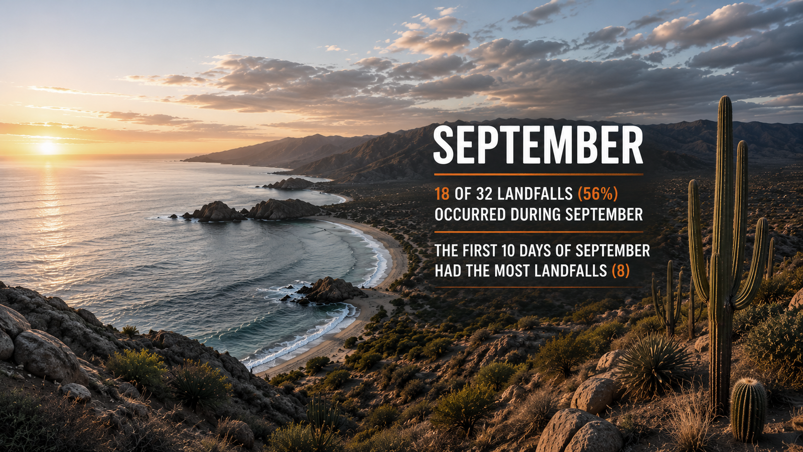
A CICESE analysis of National Hurricane Center records identified 32 named tropical cyclones that made landfall in Baja California Sur between 1970 and 2009. Of those 32 storms, 18 made landfall during September. In other words, about 56 percent of the landfalls identified during that 40-year period occurred during a single month.
The obvious question is why. The eastern Pacific can be quite active long before September, and powerful hurricanes routinely develop in June, July, and August. What makes September particularly important to Baja is not simply the number of storms that exist. It is the combination of where those storms form, where they travel, how warm the ocean has become, and whether atmospheric conditions provide them with a route north toward the peninsula.
Most eastern Pacific hurricanes never threaten Baja
The eastern Pacific is one of the world's most active tropical cyclone basins, but much of that activity has little effect on Baja California Sur. A typical storm develops south or southwest of mainland Mexico and moves generally west or west-northwest. It may strengthen considerably along the way, sometimes becoming a major hurricane, while continuing farther into the open Pacific.
Anyone who follows eastern Pacific storms for a season will quickly become familiar with this pattern. A new tropical storm forms, forecasts show it becoming a hurricane, and its projected track gradually carries it farther away from Mexico. Some systems eventually travel thousands of miles across the Pacific.
Baja is well north of the region where most of these storms develop. For a tropical cyclone to become a significant threat to the peninsula, it generally needs to gain latitude rather than simply continuing west. This is one reason that counting the total number of hurricanes in the eastern Pacific does not tell us very much about Baja's actual hurricane risk.
A busy hurricane season can produce little meaningful activity in Baja, while a relatively quiet season can still produce the one storm whose track matters.
What makes a hurricane turn toward Baja?
Hurricanes do not determine their direction independently. Their movement is largely controlled by the broader atmosphere surrounding them, particularly large areas of high and low pressure that create what meteorologists call steering currents.
For much of the eastern Pacific hurricane season, the prevailing pattern encourages storms to move westward. A large subtropical ridge of high pressure commonly sits to the north of the tropical cyclone development region, helping steer storms toward the west or northwest and away from land.
That pattern is not permanent. A weakness in the ridge, an approaching trough, or another change in atmospheric circulation can provide a path for a tropical cyclone to move farther north. A storm that appeared likely to disappear into the Pacific can then begin turning northwest or north, bringing Baja into the picture.
Research into Baja California Sur's tropical cyclone history has found that many of the storms responsible for the state's most significant rainfall had a strong northward component to their tracks. This makes sense geographically. A hurricane forming several hundred miles south of Baja has to travel north to get here.
September occurs while plenty of tropical systems are still developing in the eastern Pacific. When the steering pattern becomes favorable for a northward-moving storm, there is a greater chance that a storm will be available to take advantage of that route.
The ocean is different by September
Ocean temperature provides another important part of the explanation. Tropical cyclones depend on warm water for their energy, and the waters surrounding southern Baja have had months to warm by the time September arrives.
This matters because Baja California Sur is near the northern edge of the eastern Pacific region that regularly supports tropical cyclones. Farther south, sufficiently warm water is readily available during much of hurricane season. As storms travel north toward Baja, however, ocean temperatures increasingly become a limiting factor.
By late summer, warm water extends farther north than it did earlier in the season. The Gulf of California can become particularly warm, while the waters surrounding the southern tip of the peninsula are near their seasonal maximum temperatures. A storm traveling toward Baja in September therefore tends to have a more favorable ocean beneath it than a storm attempting the same journey much earlier in the summer.
The contrast between Baja's two coasts makes the situation even more interesting. The Gulf of California can remain exceptionally warm, while the Pacific side of the peninsula becomes increasingly influenced by the cooler California Current farther north. This is one reason tropical cyclones often weaken as they travel northwest along Baja's Pacific coast.
Southern Baja sits in an unusual transition zone. It is far enough south to be exposed to powerful tropical cyclones, but far enough north that the ability of those storms to reach it is strongly affected by the seasonal warming of the ocean.
The numbers show how unusual September really is
The historical distribution of Baja landfalls makes the seasonal pattern difficult to miss. In Farfán's analysis covering 1970 through 2009, only one of the 32 tropical cyclone landfalls occurred in July. Seven occurred in August and six in October.
September accounted for 18.
Even within September, the distribution was notable. Eight of the 32 landfalls in the entire 40-year analysis occurred during the first ten days of the month.
The exact percentages will change depending on the years examined and how a tropical cyclone crossing or landfall is defined. The 56 percent figure should therefore not be interpreted as meaning that 56 percent of every Baja hurricane season's risk occurs in September. It does, however, demonstrate how heavily the historical record was concentrated around this part of the calendar.
A separate study examining hurricane and tropical-storm landfalls along both Mexican coasts also identified September as the month of maximum activity. Research focused on the Pacific coast has likewise found Baja California Sur to be the Mexican state with the greatest number of tropical cyclone landfalls during the periods studied.
September's importance is not simply a local impression created by a few memorable storms. It appears clearly in the historical data.
September is also an important part of Baja's rainfall story
Hurricanes are usually categorized and discussed according to their wind speeds, but rainfall has always been one of their most important effects in Baja California Sur. In a state where much of the landscape is desert, a single tropical cyclone can account for an extraordinary portion of the year's precipitation.
Farfán's analysis found that September accounted for 35 percent of the monthly maximum rainfall events identified at Cabo San Lucas. October accounted for 22 percent and August for 15 percent.
Individual storms show just how extreme this can become. Hurricane Juliette produced 396 millimeters of rain at Cabo San Lucas in September 2001, an amount equivalent to roughly 80 percent of Cabo's total rainfall for that year. Some locations farther north received considerably more.
Hurricane Nora produced another remarkable example in September 1997. Loreto recorded 319 millimeters of rain in a single day, approximately twice the area's long-term average rainfall for an entire year.
This relationship between tropical cyclones and rainfall is one of the unusual features of Baja's climate. The same storms capable of producing destructive flooding can also deliver water that is enormously important to the peninsula's ecosystems, groundwater, ranching communities, and water supply. In some years, a substantial portion of the rain Baja receives can be associated with only a few tropical weather events.
September sits near the center of that relationship.
Baja's hurricane history reflects the pattern
A list of significant September storms reads like a substantial portion of Baja's recent hurricane history.
Hurricane Nora affected the peninsula in September 1997 and produced exceptional rainfall around Loreto. Hurricane Juliette followed in September 2001, bringing enormous rainfall totals to southern Baja. Hurricane John made landfall on the southeastern side of the peninsula as a Category 2 hurricane on September 2, 2006, then spent more than 40 hours moving across Baja California Sur.
Jimena struck in early September 2009. Five years later, Hurricane Odile made landfall near Cabo San Lucas on September 14, 2014, becoming one of the most destructive hurricanes in the modern history of Los Cabos. Olaf made landfall near San José del Cabo in September 2021, and Hurricane Kay affected a large portion of the peninsula the following September.
There have also been important storms in August and October, and tropical cyclones certainly do not become harmless when the calendar changes. Hurricane season lasts until the end of November for a reason. The historical concentration in September is nevertheless unusually strong.
Climatology is not a forecast
There is an important limitation to all of these historical patterns. Knowing that September has historically been Baja's most important hurricane month does not tell us whether this September will be active, quiet, or somewhere in between.
Seasonal hurricane outlooks can estimate whether the eastern Pacific as a whole is likely to produce more or fewer storms than normal, but they cannot tell us months in advance whether one of those storms will make landfall in Los Cabos, La Paz, Loreto, or anywhere else in Baja California Sur.
That depends on weather patterns that develop on much shorter timescales. A small change in a ridge of high pressure hundreds of miles away can eventually determine whether a hurricane turns north toward Baja or continues harmlessly west. Those details only become predictable as an individual storm develops and the surrounding atmospheric pattern comes into focus.
September therefore represents elevated historical risk, not a prediction. There have been quiet Septembers before, and there will be quiet Septembers again.
Why September stands apart
There is no single reason September became BCS's hurricane month. It happens because several pieces of the tropical weather puzzle are more likely to fit together at the same time.
The eastern Pacific is still in one of the most active portions of its season, providing plenty of potential storms. The ocean around southern Baja has reached its late-summer warmth, making it easier for tropical cyclones to survive farther north. At the same time, changing atmospheric steering patterns occasionally provide the northward route a storm needs to reach the peninsula instead of continuing west across the Pacific.
Most eastern Pacific storms will still never threaten Baja. Even during September, many form, strengthen, and disappear into the open ocean without having any meaningful effect on the peninsula.
The historical record shows, however, that when the pieces do line up in Baja's direction, they have lined up remarkably often in September. In one 40-year CICESE analysis, more than half of all tropical cyclone landfalls in Baja California Sur occurred during that month.
Hurricane season may begin in May, but history gives Baja California Sur a good reason to pay particularly close attention when September arrives.
Sources
- Tropical Cyclone Climatology — National Hurricane Center
- Relationships Between Tropical Systems and Rainfall in the Baja California Peninsula, Mexico — American Meteorological Society
- Climatology of Landfalling Hurricanes and Tropical Storms in Mexico — Atmósfera
- Tropical Cyclone Statistics in the Northeastern Pacific — Atmósfera
- Observations and Forecasts from the Landfall of Tropical Cyclones John, Lane, and Paul (2006) over Northwestern Mexico — Weather and Forecasting
- Tropical Cyclone Report: Hurricane Odile (EP152014) — National Hurricane Center
- Tropical Cyclone Report: Hurricane Olaf (EP152021) — National Hurricane Center
- Tropical Cyclone Report: Hurricane Kay (EP122022) — National Hurricane Center