
Weather · Coast · Preparedness
Mar de Fondo: How Distant Storms Send Waves to Mexico’s Pacific Coast
Clear skies and light winds can hide a powerful ocean swell. Learn how distant storms create mar de fondo and why the same waves affect nearby beaches differently.
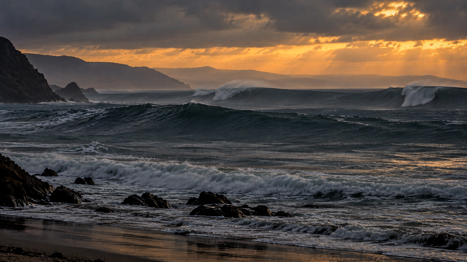
The sky can be clear. The wind near shore can be light. There may be no tropical storm, hurricane, or other threatening weather anywhere near the coast. Yet powerful waves can still begin arriving along Mexico's Pacific beaches.
Mexican weather and civil protection agencies call this phenomenon mar de fondo. It refers to long-period ocean swell generated by storms far out at sea. For anyone accustomed to judging the ocean by the weather overhead, that can seem contradictory. It makes much more sense once you stop thinking of an ocean wave as a moving wall of water and start thinking of it as moving energy.
It begins with wind
Most ocean waves begin with wind. As wind blows across the water, friction transfers energy from the atmosphere into the sea. Small disturbances grow into waves, and those waves can become much larger when the wind is stronger, blows for a longer time, and acts across a greater distance of open water. Meteorologists and oceanographers call that distance fetch.
Large storms over the open Pacific can provide all three ingredients at once. Strong winds may blow across hundreds of kilometers of ocean for many hours or days, creating a confused field of waves with different heights, wavelengths, and periods.
Some of those waves eventually travel beyond the winds that generated them. Once they leave the storm area, they become swell. The longer-period components generally travel faster than shorter-period waves, so the chaotic sea near the storm gradually sorts itself as the swell moves away. Far from its source, the resulting wave pattern can become much more regular and organized than the rough water where it began.
That is the basic process behind mar de fondo.
The energy travels, not the same body of water
It is tempting to imagine a wave leaving a storm and carrying the same water all the way across the Pacific. That is not what happens.
Ocean waves primarily transfer energy through the water. Individual water particles move in roughly circular or orbital paths as a wave passes, but they do not travel across the ocean with the crest itself. This allows swell to continue moving even after the weather system that produced it has weakened or disappeared.
Why wave period matters
Wave height gets most of the attention in beach forecasts, but period is also important. Wave period is the time between successive crests passing a fixed point.
Locally generated wind waves tend to have shorter periods and a rougher, less organized appearance. Swell from a distant weather system generally has a longer period and is often more regular.
Long-period swell also interacts differently with the coast. Its energy extends deeper into the water column and begins responding to the seafloor farther offshore than shorter-period waves. A swell of a given height can therefore produce very different surf depending on its period, direction, and the shape of the coastline it encounters.
Deep water lets swell travel. Shallow water transforms it.
Far offshore, long-period swell may not look particularly dramatic. The wavelength can be very long, with a gradual rise and fall spread across a large horizontal distance.
As the swell enters shallower water, the seafloor begins affecting its motion. The waves slow, their wavelength shortens, and their height can increase. Eventually they become unstable and break.
The seabed also changes the direction and concentration of wave energy through a process called refraction. Underwater ridges, reefs, points, bays, steep beaches, and gradually sloping bottoms can all influence how incoming swell behaves.
That is why the same offshore swell can create relatively modest surf at one location and much larger or more dangerous conditions at another beach nearby. The incoming swell supplies the energy, but local coastal geography helps determine how that energy reaches shore.
Why calm weather can be misleading
The weather at the beach normally gives us useful clues about what the ocean is doing. Strong onshore winds, dark clouds, and a nearby storm all suggest that conditions may be rough. Mar de fondo breaks that intuitive connection because the waves were produced somewhere else.
A beach can therefore sit beneath blue skies and light local winds while powerful swell is arriving from beyond the horizon. That is one reason marine and surf conditions should not be judged solely by the weather visible from shore.
Large breaking waves are one concern, but they are not the only one. Waves continually move water toward the beach, and that water eventually has to return offshore. Under the right conditions, some of that return flow can become concentrated into narrow, fast-moving channels known as rip currents.
Whether that happens depends on the beach, sandbars, structures, tide, swell direction, and other local factors. Mar de fondo can also contribute to strong shorebreak, beach erosion, coastal overtopping, and hazardous conditions for small boats when the incoming swell is sufficiently energetic.
Mar de fondo is not a tsunami
Mar de fondo and tsunamis can both bring waves to a coastline from distant sources, but the mechanisms are completely different.
Mar de fondo begins with wind transferring energy into the ocean during storms. A tsunami results from the sudden displacement of a large volume of water, most commonly from an undersea earthquake, although landslides and volcanic activity can also generate them.
Mar de fondo is also different from storm surge. Storm surge is an abnormal rise in coastal water level caused primarily by the winds of a nearby storm pushing water toward shore. Mar de fondo is a travelling swell rather than a rise in sea level caused by local storm winds.
And "fondo" does not mean the bottom of the ocean
The name can create another understandable misconception. Fondo can mean bottom or depth in Spanish, but mar de fondo does not describe waves generated on the ocean floor.
Mexico's CENAPRED explains that the term refers to swell originating over remote, deep ocean waters. The process still begins at the surface, where wind transfers energy into the sea.
English does not have one universally used term that maps perfectly onto mar de fondo. Depending on context, English-language forecasts and ocean discussions may refer to distant swell, long-period swell, or groundswell.
It can affect much of Pacific Mexico
Mar de fondo is often associated with southern Mexico, particularly Guerrero and Oaxaca, where large surf events receive considerable attention. Its reach is much broader.
CENAPRED identifies Baja California Sur, Sinaloa, Nayarit, Jalisco, Colima, Michoacán, Guerrero, Oaxaca, and Chiapas among the Pacific states that can experience it. The agency says the phenomenon can occur throughout the year but is most common from May through November.
That geographic range covers much of the coastline now followed by BajaStorms. A broad swell event can affect Baja California Sur and multiple mainland states, although individual beaches may experience very different conditions because of swell direction, exposure, and local coastal geography.
The term appears regularly in Mexican marine forecasts and civil protection information, even though many English-speaking residents and visitors may never have encountered it before.
Not every mar de fondo event is dangerous
The presence of distant swell does not automatically mean extreme surf or dangerous beach conditions. Wave height, period, direction, tides, coastal exposure, and underwater topography all help determine the outcome.
A protected bay may experience little trouble while an exposed Pacific beach receives much larger breaking waves. Conditions can also change as tides shift or new swell energy arrives.
This is why mar de fondo should be understood as a description of the origin and character of the swell, not as a severity category. When conditions become hazardous, Mexico's Servicio Meteorológico Nacional, Protección Civil agencies, lifeguards, and local authorities may issue more specific guidance about surf, waves, coastal flooding, or beach conditions.
Weather can arrive by water
Mar de fondo is a useful reminder that conditions along a coastline are not determined only by the atmosphere overhead. Storms can transfer energy into the Pacific, and that energy can later arrive at shore as organized swell.
By the time it reaches shallow water, the shape of the coastline and seafloor determine much of what happens next. That is how a beach can have clear skies, light winds, and no nearby storm while the ocean tells a very different story.
Sometimes the important weather is happening beyond the horizon, and the waves arrive before any visible sign of it does.
Sources
- Mar de fondo: What is it and how can we protect ourselves? — CENAPRED
- What you didn't know about mar de fondo — CENAPRED
- General weather forecast — Servicio Meteorológico Nacional / CONAGUA
- JetStream: Waves — NOAA
- Why does the ocean have waves? — NOAA National Ocean Service
- What causes ocean waves? — NOAA Ocean Exploration
- Rip Currents: The Hidden Hurricane Hazard — NOAA / National Hurricane Center
- Rip Current Frequently Asked Questions — NOAA / National Weather Service